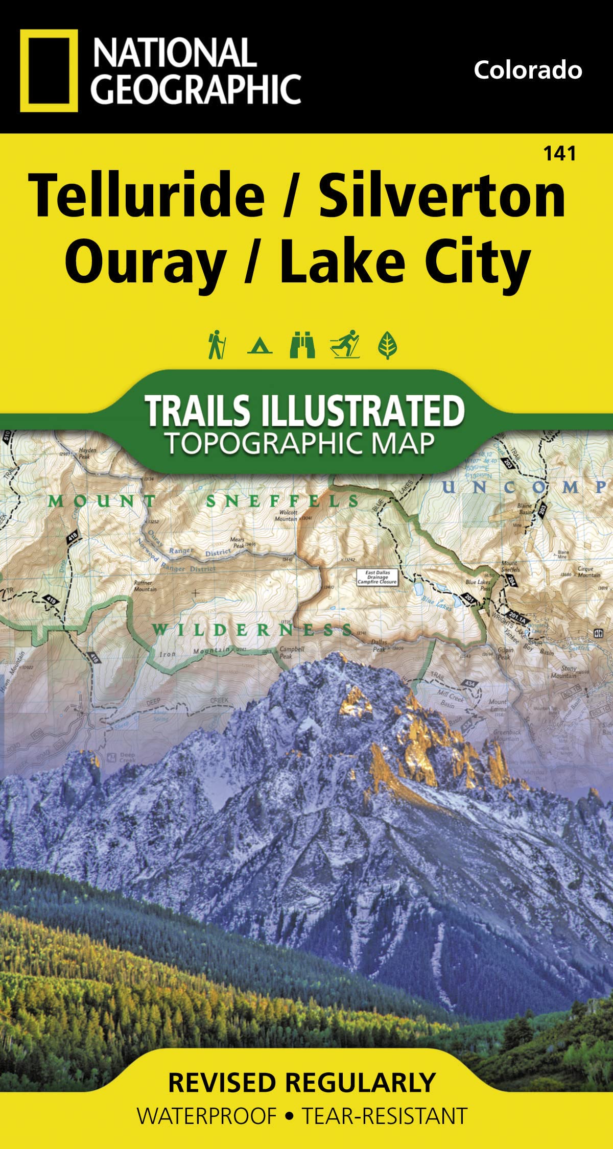


Telluride, Silverton, Ouray, Lake City Map (National Geographic Trails Illustrated Map, 141)
P**D
Always the best!
These NatGeo maps are always my favorite. Whether hiking, Jeeping, canoeing, or otherwise exploring, we always pick one up if it’s available. This map shows all of the Jeep trails around the Telluride/Ouray/Silverton area, which we used to complete some Jeep badges.While tools such as OnX Off-road are great to have, nothing compares to making a game plan with your group at camp over a paper map. That being said, the main downside of this map is that many of the most popular trails were cut in half by the front and back portions of the map. It was a pain to flip back and forth while doing Black Bear Pass for instance.While it has the one downside, the simple yet thorough and familiar layout of this map make it worth your while. It shows bathrooms, mines, and points of interest better than most maps we’ve used. Pick one up if you’re heading to the area!
A**R
Shows all the trails and more
Planes a trip to off-road in Silverton. I hesitated getting it because I thought it would be a waste of $. Got it anyway and holy cow was I impressed. It has all the trails that three of my Nav systems display. In addition, the map has a whole lot more. Because of this map, I added more trails to my to do list while in Silverton, including some hiking trails. It really helped orient myself with the area.
O**N
Map
Great map to have when your planning your trip to that area.
T**R
Best for the purpose!
My map box (converted ammo box) has always had all of the National Forest maps for my home state of Colorado, plus some of Wyoming and New Mexico. Now it's really filling up with these AWESOME water-resistant, tear-resistant, very detailed maps. I'm over 60 and frequently hike alone into fairly remote places, but not without one of THESE MAPS & a compass, GPS & batteries, UDAP bear spray, and an ACR Personal Locator Beacon. The maps are what I really use, both to find may way in and out, and to ensure that I'm fishing on public -- not private -- property. Can't live without 'em.
J**N
Excellent Detail except...
The map and subsequent detail within are excellent. However, and for my particular use, not so. My main focus was in the Ouray / Telluride / Silverton triangle. This map basically divided that area in half, requiring constant front and back flipping of the map. Had I known this before, I would not have bought it. The few images on the website did not show this or mention it. I will not return it as there still is valuable information on it outside my main area of interest.
P**R
Nice map
Good quality map with the waterproof coating but yet folds nicely
A**R
Really good map for a great area to visit!
This is a very good quality map. Ouray is one of the most beautiful place in the United States! We have been off-roading there on two occasion on the Alpine Loop in the past. I purchased one of these maps a few years ago for our earlier trips and ended up giving it to my niece for her planning and future trip. Now, I am planning on going again myself and have found nothing better for a Jeep trip!
C**S
Very helpful
I bought this to add to the books I had about this area of Colorado. It was an excellent addition. The coating on the map keeps it in good shape for the future. The detail was exactly what I was looking for and it covered all of the areas I wanted. I have been very happy with this purchase. If you plan on a trip to Southwest Colorado, this is definitely worth taking along!
Trustpilot
1 month ago
4 days ago
