
DOWNLOAD DE APP


Klantenservice
Copyright © 2025 Desertcart Holdings Limited
DOWNLOAD DE APP


🗺️ Own the world—plan, learn, and explore like a pro!
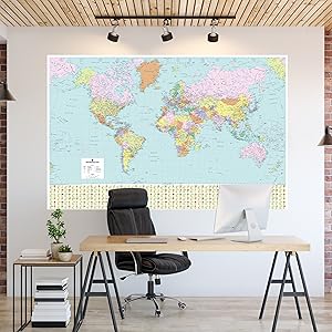
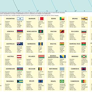
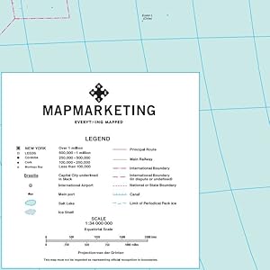
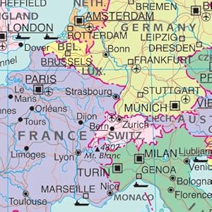
This large 120cm x 83cm laminated world map by Map Marketing features detailed political boundaries, country data, major transport hubs, mountain ranges, and time zones with analogue clocks. Encased in a durable aluminium frame, it’s perfect for education, travel planning, and interactive use with wipeable pens.

| Manufacturer | Map Marketing |
| Brand | Map Marketing |
| Material Type | Laminated Aluminium Frame |
| Manufacturer Part Number | BEX |
Trustpilot
4 dagen geleden
1 maand geleden
4 dagen geleden
3 weken geleden